Wollongong, NSW
By Lauren McCaleb · Reviewed by Dylan Duncan ·
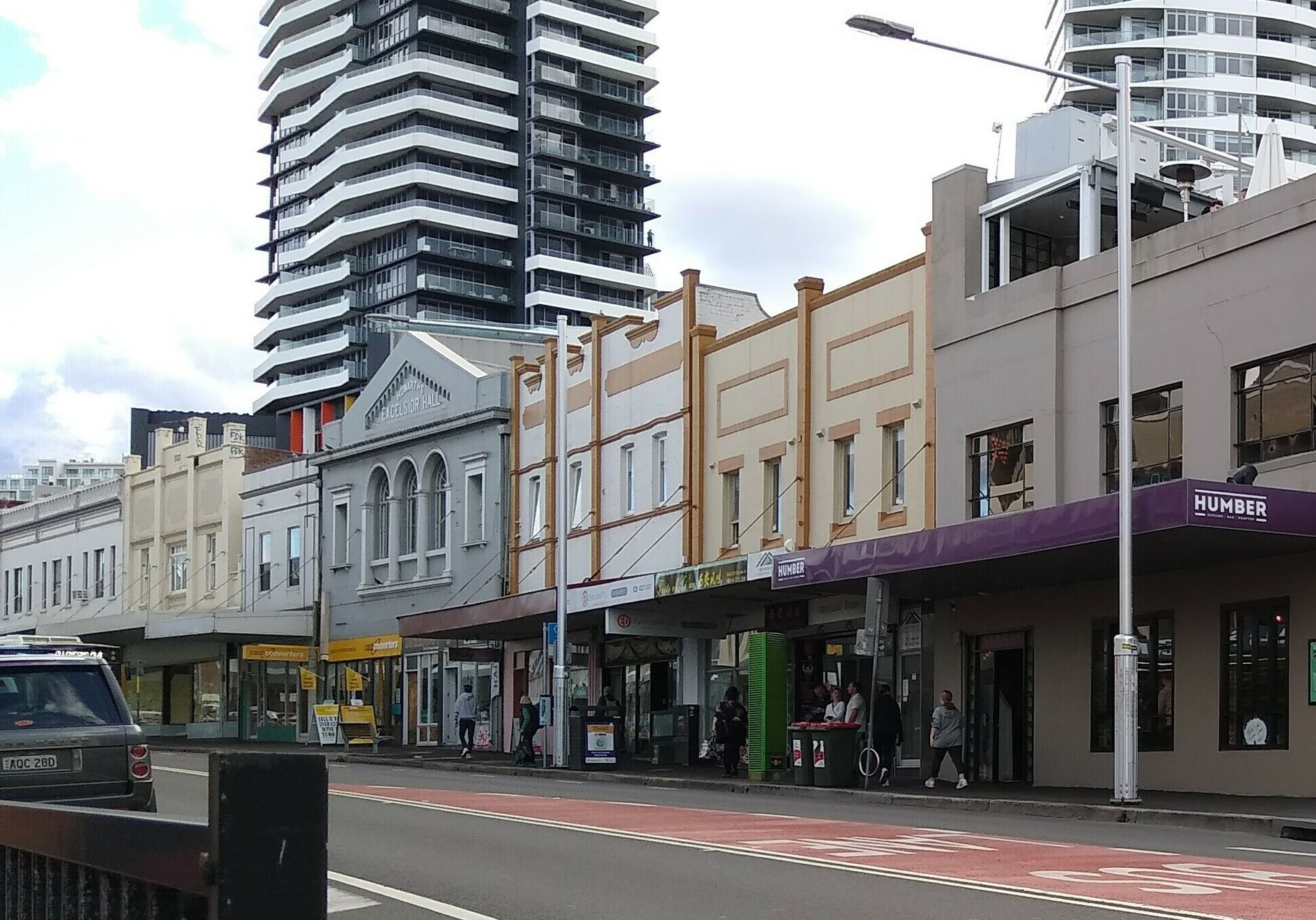
Wollongong lies on a narrow coastal plain about 85 kilometres south of Sydney, hemmed between the Tasman Sea and the steep Illawarra Escarpment. The city is known for its surf beaches, the clifftop Sea Cliff Bridge, the University of Wollongong, the Nan Tien Buddhist temple, and the steelworks at nearby Port Kembla — the legacy of an economy long built on coal and steel that is now broadening into education, services and tourism. The area is the traditional Country of the Dharawal people, for whom it is known as Woolyungah. The name Wollongong is believed to derive from a Dharawal word, variously said to mean 'five islands', 'ground near water' or 'the sound of the sea'.
More advantaged than the national average
Wollongong is more socio-economically advantaged than about 71% of the 14,462 Australian suburbs we score, based on the ABS SEIFA index (raw score 1024, where about 1000 is the national average).
A socio-economic measure from ABS Census data — not a measure of how good a suburb is to live in or visit. How we calculate this.
Is Wollongong a good place to live?
There’s no single answer — it depends on what matters to you. So instead of one mystery number, we break it down: a transparent score on each part of life we can back with public data, and an honest “not yet” on the parts we can’t.
Around the national middle
A weighted blend of the 3 components we can score for Wollongong from public data. It sits alongside — and reconciles with — the socio-economic Suburb Score above; it is a transparent read, not a complete verdict.
Socio-economic advantage
71/100More advantaged than the national average
More advantaged than the national average — the same ABS SEIFA-based Suburb Score (71/100) shown above. Income, education and occupation, as published by the ABS. · ABS SEIFA 2021
Housing affordability
16/100Among the more expensive suburbs
Median weekly rent was $410 at the 2021 Census — more affordable than about 16% of suburbs we can compare. Housing data only, no valuations. · ABS Census 2021
Amenities & access
92/100Plenty mapped nearby
About 238 everyday places (cafés, shops, services and more) mapped within ~1.2 km of the centre. · OpenStreetMap
Not yet scored
We’d rather leave these open than publish a number we can’t stand behind. Here’s where each one stands.
- Green spaceNot scored yet — our OpenStreetMap green-space mapping is still rolling out across suburbs.
- TransportNot scored yet — our OpenStreetMap public-transport mapping is still rolling out across suburbs.
- SchoolsNot scored yet — school performance (ACARA / ICSEA) needs a data-reuse licence cleared before we can publish it.
- SafetyNot scored yet — Australia has no single open crime dataset and safety data carries defamation and legal care, so it is gated pending a go/no-go and will be data-only when added.
- CommunityNot scored yet — we won't reduce community to a number from a proxy. We'd rather leave it open than publish an invented value judgement.
A transparent read on public data, not a verdict — and not a measure of any person or community. See our methodology for how each component is worked out and why some aren’t scored yet.
Wollongong at a glance
- Population (2021)
- 20,446
- Median age
- 35
- Median weekly household income
- $1,549
- SEIFA score
- 1024
- Local government area
- Wollongong
- Coordinates
- -34.4286, 150.8930
Map of Wollongong
© OpenStreetMap contributors · View larger map
Housing & property in Wollongong
What it costs to live in Wollongong and how residents hold their homes, from the Australian Bureau of Statistics 2021 Census.
- Median rent
- $410
- per week
- Median mortgage
- $1,950
- per month
- Owner-occupied
- 42%
- of dwellings
- Rented
- 55%
- of dwellings
The full tenure and dwelling-type breakdown is in the Wollongong demographics section below.
Source: ABS Census of Population and Housing, 2021. © Australian Bureau of Statistics, released under CC BY 4.0. See our methodology.
Wollongong demographics (2021 Census)
The figures below profile Wollongong using the Australian Bureau of Statistics 2021 Census; every percentage is a share of a clearly stated Census count, so each one traces back to the source. At a glance, the largest age group is young adults (25–44) at 35% and 34% of residents were born overseas.
Age profile
| Age group | People | Share |
|---|---|---|
| Children (0–14) | 1,787 | 9% |
| Youth (15–24) | 3,449 | 17% |
| Young adults (25–44) | 7,115 | 35% |
| Mid-life (45–64) | 4,248 | 21% |
| Seniors (65+) | 3,848 | 19% |
Share of the 20,447 people counted by age.
Housing and households
| Tenure | Dwellings | Share |
|---|---|---|
| Owned outright | 2,297 | 24% |
| Owned with a mortgage | 1,685 | 18% |
| Rented | 5,194 | 55% |
| Dwelling type | Dwellings | Share |
|---|---|---|
| Houses | 1,318 | 14% |
| Townhouses & semis | 702 | 7% |
| Flats & apartments | 7,365 | 77% |
Tenure and dwelling shares are of the roughly 9,518 occupied private dwellings in Wollongong.
- Average household size
- 2 people
- Median weekly family income
- $2,034
- Median weekly personal income
- $836
Community and culture
- Born overseas
- 6,535 (34%)
- Speaks a language other than English at home
- 5,550 (29%)
- Aboriginal and/or Torres Strait Islander
- 398 (2%)
Work and education
- Completed Year 12
- 11,976 (65%)
- Labour-force participation
- 60.1%
- Unemployment rate
- 5.6%
- Employed full-time
- 5,821
- Employed part-time
- 3,422
Source: ABS Census of Population and Housing, 2021 (General Community Profile, by Suburb and Locality). © Australian Bureau of Statistics, released under CC BY 4.0. How we group bands and derive each share is set out on our methodology page.
Weather and climate in Wollongong
Based on 2014–2023 records, the warmest month in Wollongong is January (average daytime high around 25.9°C) and the coolest is July (around 16.7°C). The area receives roughly 1070 mm of rain across the year.
| Month | Avg high | Avg low | Rain |
|---|---|---|---|
| Jan | 25.9°C | 18.8°C | 101 mm |
| Feb | 25.1°C | 18.4°C | 117 mm |
| Mar | 24.1°C | 17.5°C | 169 mm |
| Apr | 21.9°C | 14.5°C | 94 mm |
| May | 19.3°C | 11.4°C | 57 mm |
| Jun | 16.8°C | 9.6°C | 76 mm |
| Jul | 16.7°C | 8.2°C | 83 mm |
| Aug | 17.4°C | 8.6°C | 66 mm |
| Sep | 19.7°C | 10.5°C | 53 mm |
| Oct | 21.7°C | 13°C | 92 mm |
| Nov | 22.8°C | 14.8°C | 79 mm |
| Dec | 24.7°C | 16.9°C | 83 mm |
Climate normals, 2014–2023 (Open-Meteo, ERA5 reanalysis).
Places in and around Wollongong
Amenities mapped within about 1.2km of the suburb centre, from OpenStreetMap. A guide to what's nearby — not a complete directory.
Eat & drink
106 nearbyMcDonald's · Dicey Riley's · Caveau · Lorenzo's · Nam · Fat Boy Grill & Pide
Parks & recreation
95 nearbyAustralian Academy Tai Chi · Club Lime · Fittech Studios · Lang Park · Osborne Park · Greenhouse Park
Shops & groceries
11 nearbyColes · Oz Bánh Mì Bakery · OZ Star · Burek · Quick Mart Wollongong · Dong Phuong Asian Supermarket
Healthcare
12 nearbyHospital Hill Pharmacy · Chemist Warehouse · Illawarra Radiology Group · Illawarra Cancer Care Centre · Downtown Pharmacy · Jones Dental
Schools & education
6 nearbyIllawarra Hospital School · Wollongong Public School · Coniston Primary School · St Mary's Star of the Sea · West Wollongong TAFE · Smith's Hill High School
Things to do
8 nearbyWollongong City Library · Ted Tobin OAM Observation Deck · Pinot & Picasso · Wollongong Art Gallery · Illawarra Performing Arts Centre (IPAC) · Illawarra Historical Society Inc & Illawarra Museum
Eat & drink in and around Wollongong
Cafés, restaurants, pubs and takeaway mapped within about 1.2km of the suburb centre. Listings are drawn from OpenStreetMap and shown as plain data — we don't rank or rate them.
Own a café, restaurant or pub around here?
Claim your listing to feature it at the top of this section. Placement is paid advertising, clearly labelled — never editorial opinion.
Claim this listing- AmiRestaurant
- AmigosRestaurant
- An Chut ChutRestaurant87a Crown Street, Wollongong
- Ariel's WollongongCafé
- AseesRestaurantWollongong
- Bucks CafeCafé
- Bull & BearCaféVictoria Street, Wollongongbullnbear.com.au
- CaveauRestaurant
- Centro CBDRestaurant28 Stewart Street, Wollongong
- Ceren'sTakeaway
- ChopstixTakeaway
- Ciao CucinaRestaurant112-114 Corrimal Street
- Daughter Judy'sTakeaway
- Deli and DineCafé22 Market Street
- Dicey Riley'sPubCrown Street
- Dosa HouseRestaurant
- Fat Boy Grill & PideTakeawayMarket Street
- Food WorldRestaurantKeira Street, Wollongong
- Gong ChaCafé145-148 Crown Street, Wollongong
- Grill'dTakeaway
- Guzman y GomezTakeawayWollongong
- HanokRestaurant
- Hero SushiRestaurantWollongong
- HibikiTakeaway
- His Boy ElroyTakeawayKeira Streethisboyelroy.com.au
- Hong Kong ChefRestaurant
- ilu ilu barBar10-18 Regent Street, Wollongongilubar.com.au
- JasmineRestaurant
- KFCTakeawayWollongong
- KinnRestaurant
- Kneading RubyRestaurant
- Koon Hong & Time for TeaCafékoonhong.square.site
- KulchaTakeaway
- Lettuce B. FrankCaféCrown Street, Wollongong
- Little VietnamRestaurant
- Living RoomRestaurant
- Lorenzo'sRestaurant
- McDonald'sTakeawayWollongong
- Miss Lee'sRestaurantKeira Street, Wollongong
- Moon’s SushiRestaurantfacebook.com
- MylanRestaurant
- NamRestaurant
- Rainbow Fried DelightsTakeaway
- Rippongi Japanese RestaurantRestaurant102 Market Street
- Saltie DogCafé
- SamarasRestaurant123 Corrimal Streetsamarasrestaurant.com
- SchnitzTakeaway
- Seoul MateRestaurant
- ShareteaCaféCrown Street, Wollongong
- Son of a GunCafé
- Soul OriginTakeaway
- Steaky BurgerTakeaway
- SubwayTakeawayWollongong
- Texas SizzleRestaurant
- Thai NiyomTakeaway
- ThaiGongRestaurant179-181 Keira Street
- The SocialCafé
- Top ChoiceRestaurantWollongong
- Top JuiceTakeaway
- UtopiaCafé
Showing 60 mapped places; more may exist that aren't yet on OpenStreetMap.
Listings © OpenStreetMap contributors, ODbL. Own a venue here? Suggest a correction.
Share your local knowledge of Wollongong
Lived here or spent time in Wollongong? Add a review or a quick tip. Reviews and tips are moderated before they appear.
Common questions about Wollongong
Is Wollongong a good place to live?
There's no single answer, so we score what the public data can back. On socio-economic advantage, housing affordability and amenities, Wollongong rates 63/100 overall (Around the national middle). Public transport, schools and safety aren't scored yet — see our methodology for why.
What is the median rent in Wollongong?
At the 2021 Census, the median weekly rent in Wollongong was $410, and the median monthly mortgage repayment was $1,950. These are official ABS Census figures — StreetScout publishes housing data only, with no property valuations or agent referrals.
Where is Wollongong?
Wollongong is a suburb of New South Wales, Australia, in the Wollongong local government area.
What is the population of Wollongong?
At the 2021 Census, Wollongong had a population of about 20,446.
Is Wollongong an advantaged area?
Wollongong has an ABS SEIFA score of 1024, where about 1000 is the national average — higher scores indicate greater relative socio-economic advantage. That gives it a Suburb Score of 71 out of 100 — more socio-economically advantaged than about 71% of Australian suburbs.
What is the weather like in Wollongong?
Wollongong has average daytime highs of about 21.3°C and overnight lows of about 13.5°C, with roughly 1,070 mm of rain across the year (based on 2014–2023 climate normals).
Nearby suburbs in New South Wales
More suburb guides in New South Wales
Other hand-written, cited guides — browse all guides.